

Polar Vortex Forecast 2026–2027: U.S. Winter Outlook
Last updated:

Will the U.S. have a colder winter in 2026–2027?
Probably not as a whole. The latest NOAA seasonal outlook favors above-normal average temperatures across much of the northern United States and many areas west of the Rockies through a large part of winter. Much of the Southeast trends closer to normal later in the season, while a strong El Niño favors a wetter storm track across the southern and central U.S.
That does not mean the polar vortex cannot deliver periods of extreme cold. One or more Arctic outbreaks can occur inside an otherwise mild three-month season, and a sudden stratospheric warming could weaken, displace, or split the stratospheric polar vortex later in winter.
What cannot be predicted this far ahead is the exact date a polar vortex outbreak will reach the United States. NOAA notes that the ingredients behind a specific sudden stratospheric warming generally become meaningfully predictable only on roughly a 7–10 day weather-forecast timescale.
The polar vortex forecast for 2026–2027 is therefore less about asking whether one giant cold wave will cover the entire country and more about separating three different questions: What does the winter average look like? Where is the storm track likely to be most active? And could a short-lived stratospheric disruption temporarily overwhelm that seasonal pattern?
That distinction matters this winter because the background climate pattern has changed dramatically from last year. The 2025–26 winter discussion centered on La Niña. For 2026–27, NOAA is monitoring a rapidly strengthening El Niño, with the October 8 update giving a greater than 83% chance that strong-to-very strong El Niño conditions persist through January–March 2027.
2026–27 Polar Vortex Forecast at a Glance
The best way to read a winter forecast for 2026–2027 is to separate what forecasters can say with reasonable confidence from what remains event-level speculation.
| Question | Current Assessment | Confidence | What It Means |
|---|---|---|---|
| Will 2026–27 be dominated by La Niña? | No. A strong-to-very strong El Niño is underway. | High | Expect El Niño to be a major driver of the winter storm track. |
| Will the entire U.S. be colder than normal? | Not favored. | Moderate to high | NOAA favors warmer seasonal averages across much of the northern tier and West. |
| Can major Arctic outbreaks still happen? | Yes. | Moderate | A mild seasonal average does not prevent several days of severe cold. |
| Will the southern U.S. be stormier? | A wetter pattern is favored. | Moderate to high | An active southern storm track increases rain and, when cold air is available, winter precipitation risk. |
| Will a major sudden stratospheric warming occur? | Too early to know. | Low this far ahead | El Niño does not rule one out, but a specific SSW cannot be forecast months in advance. |
| When will the polar vortex hit the U.S.? | No credible exact date yet. | Very low at seasonal range | Event timing usually becomes useful only as the atmosphere enters a much shorter forecast window. |
That last distinction is especially important. A seasonal forecast describes the average over weeks or months. A polar-vortex-related cold outbreak is a weather event that may last days. Both statements can therefore be true at the same time: a region can finish winter warmer than normal and still experience a damaging Arctic outbreak.
Current Polar Vortex Status: Where Things Stand in October 2026
As of early October, the Northern Hemisphere stratospheric polar vortex is entering its normal seasonal development period as sunlight disappears from the Arctic and the polar stratosphere cools. This is the time of year when the circulation begins strengthening around the pole.
That does not tell us what its condition will be in January or February.
For readers following the polar vortex this winter, the most useful source is NOAA's operational stratospheric monitoring rather than a long-range headline. The Climate Prediction Center publishes ongoing stratospheric temperature, height, and wind analyses along with model guidance that can reveal whether the vortex is strengthening normally or coming under increasing pressure from large atmospheric waves.
Current takeaway: October is a monitoring stage, not an event-prediction stage. There is not enough forecast skill today to attach a reliable U.S. cold-wave date to a possible midwinter polar vortex disruption.
What should you watch instead?
| Signal | Why It Matters | When It Becomes Useful |
|---|---|---|
| Polar stratospheric winds | A substantial weakening can indicate growing pressure on the vortex. | Monitor through winter |
| Rapid warming high over the Arctic | A major SSW involves an abrupt temperature rise in the polar stratosphere and major circulation changes. | Most useful once short- and medium-range models begin agreeing |
| Vortex displacement or splitting | A disturbed vortex can increase the chance of a wavier atmospheric pattern below. | Event scale |
| Arctic Oscillation and blocking patterns | These help determine whether cold air can move south rather than remain confined near the Arctic. | Weeks to days |
| Local NWS temperature and winter-weather forecasts | These ultimately determine whether a specific location faces dangerous cold, snow, or ice. | Days before impact |
You can follow NOAA's current stratospheric monitoring rather than relying on viral claims that assign a polar vortex outbreak to a specific date months in advance.
What NOAA's 2026–2027 Winter Outlook Actually Says
The latest full NOAA long-lead seasonal discussion available when this article was updated was issued September 17, 2026. A new set is scheduled for October 15, so the maps will continue to evolve as winter approaches.
The current outlook favors above-normal temperatures during October–December across much of Alaska, most areas west of the Rockies, the north-central states, and nearly all areas east of the Mississippi. From late fall through early spring, NOAA continues to show a broad El Niño-style pattern, with increased odds of above-normal seasonal temperatures across much of the northern tier.
Meanwhile, the dominant precipitation signal runs almost the opposite direction: a wetter-than-normal pattern is favored across much of the southern and central United States and eventually northward along parts of the Atlantic Coast.
| U.S. Region | Seasonal Temperature Signal | Precipitation Signal | What to Watch This Winter |
|---|---|---|---|
| Pacific Northwest | Warmer-than-normal averages favored in many areas, especially inland | Interior Northwest leans drier | Seasonal warmth does not eliminate short Arctic intrusions east of the Cascades. |
| California | Generally tilted warmer early, with weaker temperature signals later | Increasingly wet signal through winter | Storm intensity, mountain snow, flooding, and atmospheric-river episodes may matter more than persistent low-elevation Arctic cold. |
| Southwest | Warm tilt gradually gives way to weaker signals | Wet signal favored in parts of the region | Mountain snow and storm-track placement will be important. |
| Northern Rockies and Northern Plains | Warmer seasonal averages favored | Mixed or weaker precipitation signal | Still one of the most exposed corridors when Canadian or Arctic air breaks south. |
| Central and Southern Plains | Lower confidence in parts of the southern Plains | Wetter-than-normal conditions increasingly favored | The key winter hazard is whether shallow cold air overlaps with an active southern storm track, creating ice or sleet. |
| Great Lakes and Upper Midwest | Warmer-than-normal seasonal averages generally favored | Parts of the Great Lakes lean modestly drier | Strong but temporary Arctic outbreaks remain possible even in a mild winter average. |
| Ohio and Tennessee Valleys | Mixed to warm seasonal background depending on period | Wet signal favored | Watch storm-track and freezing-line placement for snow, sleet, or freezing rain. |
| Northeast and Mid-Atlantic | Warmer seasonal averages often favored | Wet signal expands northward during winter | Snow versus rain may depend heavily on whether a storm can coincide with a temporary source of cold air. |
| Southeast | Closer to near-normal averages during much of winter | One of the strongest wet signals | Freezing rain or sleet can become disruptive on the northern edge of the region when cold air briefly pushes south. |
Source: NOAA Climate Prediction Center Long-Lead Seasonal Outlook. Seasonal forecasts express probabilities, not guaranteed conditions at every location.
The most useful way to interpret this: NOAA is not forecasting an uninterrupted warm winter. It is forecasting the odds for the seasonal average. A five-day Arctic outbreak can be severe enough to freeze pipes, stress the grid, and produce dangerous wind chills without making the entire three-month season colder than normal.
La Niña or El Niño? The 2026–27 Winter Has Changed Direction
Anyone carrying over a La Niña forecast from last winter needs to reset that assumption.
NOAA's October 8, 2026 ENSO update confirms that El Niño continues to strengthen. The Niño-3.4 index reached +2.1°C, while portions of the eastern equatorial Pacific had sea-surface-temperature anomalies above +4.0°C.
| NOAA ENSO Indicator | October 8, 2026 Status | Why It Matters |
|---|---|---|
| ENSO alert | El Niño Advisory | El Niño is established rather than merely forecast. |
| Niño-3.4 | +2.1°C | Shows very warm equatorial Pacific conditions in a key ENSO monitoring region. |
| Niño-3 | +3.0°C | Confirms exceptionally warm conditions farther east. |
| Niño-1+2 | +3.9°C | Shows particularly strong warmth in the eastern tropical Pacific. |
| Strong-to-very strong El Niño through Jan–Mar 2027 | Greater than 83% probability | El Niño is likely to remain a major winter background driver. |
| Chance of a historically strong event during Oct–Dec | 83% | Raises confidence in El Niño-related seasonal influences, although regional impacts are never guaranteed. |
Source: NOAA CPC ENSO Diagnostic Discussion, October 8, 2026.
Does a strong El Niño mean there will be no polar vortex cold?
No. El Niño and the polar vortex operate in different parts of the climate system and on different timescales.
El Niño can strongly influence the average Pacific jet stream, U.S. storm track, temperature probabilities, and precipitation pattern. A sudden stratospheric warming, however, can disrupt the polar vortex and temporarily reorganize the circulation in ways that are not captured by simply saying “El Niño winter.”
NOAA research also shows that the relationship between ENSO and sudden stratospheric warming is not simple enough to say that El Niño guarantees or prevents an SSW.
One unusual feature makes 2026–27 different from classic strong El Niño winters
This is one of the most important details in NOAA's current forecast discussion, and it is easy to miss.
The famous strong El Niño winters of 1982–83, 1997–98, and 2015–16 occurred with a positive Pacific Decadal Oscillation, or PDO. In August 2026, the PDO index was instead strongly negative at -1.11.
NOAA says that negative PDO may damp some of the usual effects expected from a strong El Niño. Warm Gulf of Alaska waters are also positioned farther west than they typically are during the strongest historical El Niño events.
That means simply copying a 1997–98 or 2015–16 winter map and calling it the 2026–2027 winter forecast would be a mistake. This winter has an unusually strong El Niño signal, but the North Pacific background is not an exact match for those famous analog years.
If you read our earlier La Niña vs. Polar Vortex winter guide, treat it as background on how the two climate features differ rather than a forecast for the current winter. The ENSO setup has changed substantially for 2026–27.
Sudden Stratospheric Warming Risk: The Wild Card for Winter 2026–27
A sudden stratospheric warming, commonly shortened to SSW, happens when temperatures high in the polar stratosphere rise rapidly and the strong west-to-east winds associated with the winter polar vortex weaken dramatically. In a major event, those winds can reverse.
An SSW can displace or split the stratospheric polar vortex. That sometimes increases the chance of high-latitude blocking and allows Arctic air to spill farther south during the following weeks.
But three things are important:
- An SSW does not automatically send the coldest air into the United States.
- Even when the U.S. is affected, the cold may target only part of the country.
- The surface response can lag the stratospheric event and varies considerably from one event to another.
Can we forecast an SSW for January or February right now? No. NOAA notes that the specific atmospheric ingredients responsible for a sudden warming are affected by weather patterns whose exact evolution is generally predictable only about 7–10 days ahead.
Forecast confidence changes dramatically with lead time
| Lead Time | What Forecasters Can Reasonably Assess | What You Should Not Assume |
|---|---|---|
| Months ahead | Background climate factors and broad seasonal tendencies | An exact SSW date or U.S. cold-wave location |
| Several weeks ahead | Whether the large-scale pattern may become more favorable for vortex disruption | That a specific model run proves a major Arctic outbreak |
| About 7–10 days | Much more meaningful event-level assessment of stratospheric warming and vortex changes | That every SSW will produce cold where you live |
| Several days | Where Arctic air, snow, freezing rain, and dangerous wind chills are actually forecast | That national headlines are more useful than your local NWS forecast |
For the polar vortex winter 2026 story, this is the variable worth watching as December, January, and February approach. It is also the reason a seasonal “warmer than normal” map should never be treated as an all-clear for extreme cold.
Which U.S. Regions Could Get the Coldest Weather?
There is no credible October forecast showing exactly where the coldest Arctic outbreak of winter 2026–27 will occur. We can, however, separate seasonal temperature expectations from exposure when Arctic air does break south.
| Region | Why Arctic Outbreaks Matter There | Main Winter Concern |
|---|---|---|
| Northern Plains | Direct pathway for very cold Canadian and Arctic air masses | Extreme wind chill, rapid temperature drops, heating demand |
| Upper Midwest | Often exposed when deep troughing develops over central or eastern North America | Severe cold, blowing snow, travel disruption |
| Rockies and High Plains | Strong fronts can produce very fast temperature changes | Wind chill, snow, livestock and travel impacts |
| Central and Southern Plains | Less persistently cold than the northern tier, but southward Arctic surges can be high impact | Frozen pipes, power demand, sleet and freezing rain where moisture overlaps cold air |
| Ohio and Tennessee Valleys | Often near the battle zone between cold continental air and moisture from southern storm systems | Snow-to-ice transitions, freezing rain, outages |
| Northeast | Can experience strong cold if downstream troughing and high-latitude blocking align | Cold, snow, coastal storms, heating demand |
| Southeast | True Arctic conditions are less frequent, so even relatively brief freezes can be disruptive | Freezing rain, exposed plumbing, travel disruption, local outages |
The region with the coldest absolute temperature is not necessarily the region with the greatest disruption. North Dakota is built for cold that can create serious problems in Georgia or Texas.
That is why this year's strong southern precipitation signal matters. If a brief Arctic air mass meets an unusually active southern storm track, the resulting ice or heavy wet snow may create a bigger infrastructure problem than the seasonal temperature average suggests.
When Will the Polar Vortex Hit the U.S. in 2026–27?
There is no reliable hit date yet.
The polar vortex itself is a large winter circulation high above the Arctic. It exists through much of the cold season. What people usually mean when they ask “when will the polar vortex hit?” is: When will Arctic air associated with a disrupted or highly amplified atmospheric pattern move into the lower 48 states?
That distinction matters because the polar vortex is not a single storm traveling toward the U.S. on a calendar.
| Time of Winter | What Is Happening | How to Use the Forecast |
|---|---|---|
| October–November | The stratospheric vortex develops and strengthens seasonally. | Watch the background pattern, but ignore exact polar-vortex “arrival dates” months away. |
| December | Meaningful Arctic outbreaks are possible as the winter circulation becomes established. | Begin watching stratospheric trends and medium-range weather models more closely. |
| January–February | Midwinter is an important monitoring period for major vortex disruptions and high-impact cold outbreaks. | Give much more weight to NOAA/NWS forecasts as signals enter the 7–10 day event window. |
| March | Late-season stratospheric disruptions and cold outbreaks can still occur before the winter vortex ultimately breaks down. | Do not treat the end of February as an automatic end to winter-weather risk. |
This table is a planning timeline, not a prediction that an outbreak will occur in a particular month.
Snow, Ice, and Power Outage Risk in an El Niño Winter
The biggest mistake is assuming that a warmer seasonal outlook means less winter-weather risk everywhere.
Snow and ice require the right combination of cold air and moisture at the right time. The 2026–27 setup may provide plenty of moisture across parts of the southern and central U.S. because El Niño favors a stronger subtropical storm track.
If temporary Arctic air is already in place when one of those storms arrives, rain can become sleet, freezing rain, or snow. If the cold air is absent, the same storm may simply produce heavy rain.
That makes the overlap between cold air and moisture more important for individual outage events than the three-month average temperature.
| Winter Hazard | What Causes the Main Problem | Power-Outage Concern | Household Priority |
|---|---|---|---|
| Dry Arctic cold | Heating demand, frozen infrastructure, wind chill | Moderate, potentially higher during extreme demand | Protect pipes, conserve heat, keep communications powered |
| Freezing rain | Ice loading on trees and power lines | High | Prepare for outages that can outlast the precipitation itself |
| Heavy wet snow | Tree and line loading | Moderate to high | Charge backup power before the storm begins |
| Blizzard or high-wind snowstorm | Wind damage, drifting snow, limited road access | High in affected areas | Have enough essentials to avoid unnecessary travel |
| Extreme cold after an outage | Falling indoor temperatures after loss of heat | High consequence even if the outage itself is localized | Have a safe backup heat plan and know when to relocate |
The National Weather Service recommends preparing for loss of heat, electricity, communications, and access to supplies before a winter storm arrives. Its winter guidance includes flashlights, batteries, food, water, medicine, a working carbon-monoxide detector, and a safe emergency heat plan.
For a more detailed household list, see our 72-hour winter storm supply checklist.
How to Prepare for a Polar Vortex or Arctic Outbreak
You do not need to know the exact date of the season's coldest outbreak to prepare effectively. A better strategy is to prepare in stages and let forecast confidence determine when you act.
Before winter
- Test smoke alarms and carbon-monoxide detectors.
- Know how your primary heating system behaves during a power outage.
- Insulate vulnerable water lines and identify your main water shutoff.
- Keep several days of essential medications, food, and drinking water available.
- Check flashlights, batteries, weather alerts, and emergency communications.
- Test your backup power station with the actual devices you plan to use.
- Store battery equipment in a dry location within the manufacturer's storage-temperature limits.
When a meaningful cold or winter-storm signal appears several days out
- Fully recharge portable power stations and smaller battery packs.
- Charge phones, laptops, lights, radios, and other rechargeable devices.
- Refill prescriptions and essential household supplies before roads deteriorate.
- Reduce unnecessary refrigerator and freezer opening.
- Protect outdoor plumbing and hoses.
- Move temperature-sensitive battery equipment into an appropriate indoor environment before charging.
When warnings are issued
- Follow your local National Weather Service forecast rather than a national polar-vortex headline.
- Avoid unnecessary driving during ice, blizzard, or dangerous wind-chill conditions.
- Keep emergency lights and communications where they can be reached easily.
- Prioritize backup energy for refrigeration, medical devices, communications, and lighting.
- Know where you can go if your home cannot remain safely heated during an extended outage.
Generator safety: CDC guidance says fuel-burning generators should never be used inside a home, garage, basement, or near windows. They should be positioned at least 20 feet from windows, doors, and vents. Battery portable power stations operate differently because they do not use a gasoline engine, but they should still be kept dry and used according to their operating instructions.
If your portable power station has been stored in a freezing vehicle or unheated location, do not assume it is immediately ready to recharge. Battery charging limits are generally more restrictive than discharge limits. Our guides on using portable power in cold weather and storing a power station in a vehicle explain what to check before charging.
Winter Backup Power: Choose by Essential Load, Not by Storm Name
A “polar vortex” label does not tell you how much backup power you need. Your essential devices do.
Start by deciding what must keep running if the grid is down for several hours: Wi-Fi, phones, lights, a CPAP, refrigerator, laptop, or another plug-in device. Then compare its normal wattage and required runtime with the usable battery capacity available.
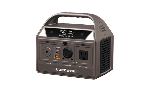
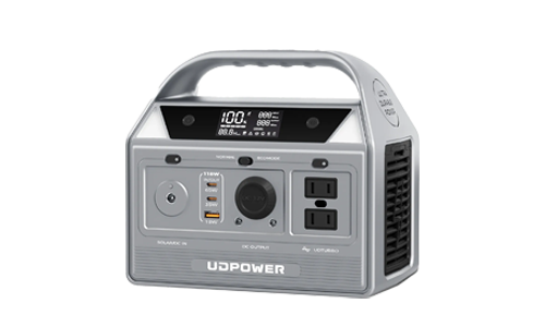
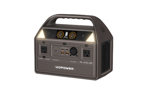
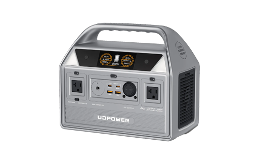
For winter outages, two UDPOWER options cover different levels of backup demand.
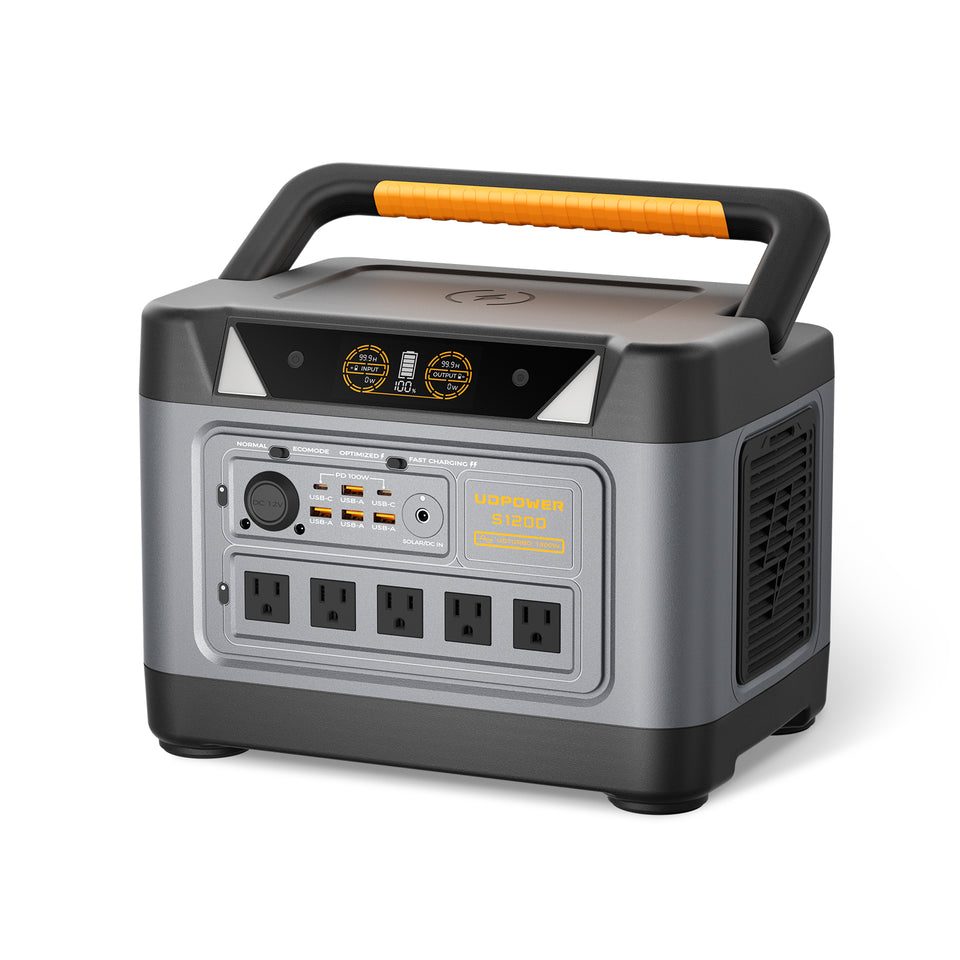
UDPOWER S1200: For Core Household Essentials
The UDPOWER S1200 combines approximately 1,190Wh of LiFePO4 battery capacity with 1,200W rated AC output and UDTURBO up to 1,800W. It is well suited to keeping smaller critical loads running without moving immediately into a much larger battery system.
- Capacity: 1,190Wh
- Rated AC output: 1,200W pure sine wave
- UDTURBO: Up to 1,800W
- UPS transfer: Less than 10ms
- Weight: Approximately 26 lb
- Solar input: Up to 400W
- Best fit: Refrigerator, CPAP, router, lights, phones, laptops, television, and similar essential loads
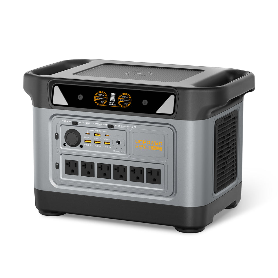
UDPOWER S2400: More Capacity for Longer or Heavier Backup Loads
The UDPOWER S2400 increases battery capacity to 2,083Wh with 2,400W rated AC output and UDTURBO up to 3,000W. The larger energy reserve makes it better suited to longer refrigerator operation, multiple essential devices, or households that want more margin during a prolonged outage.
- Capacity: 2,083Wh
- Rated AC output: 2,400W pure sine wave
- UDTURBO: Up to 3,000W
- UPS transfer: Less than 10ms
- Weight: Approximately 40.8 lb
- Best fit: Longer refrigerator backup, multiple household essentials, communications, electronics, and higher-power plug-in equipment within the unit's limits
S1200 vs. S2400 for Winter Outages
| Specification | UDPOWER S1200 | UDPOWER S2400 |
|---|---|---|
| Battery capacity | 1,190Wh | 2,083Wh |
| Rated AC output | 1,200W | 2,400W |
| UDTURBO | Up to 1,800W | Up to 3,000W |
| UPS transfer | <10ms | <10ms |
| Approximate weight | 26 lb | 40.8 lb |
| Best choice when... | You want portable backup for a focused list of essentials | You need more runtime or want to support several essential devices at once |
Approximate Runtime for Common Winter Essentials
For practical planning, the following estimates use approximately 90% conversion efficiency:
Estimated runtime = battery capacity × 0.90 ÷ device wattage
| Example Load | Planning Wattage | S1200 Estimated Runtime | S2400 Estimated Runtime |
|---|---|---|---|
| Wi-Fi router | 10W | About 107 hours | About 187 hours |
| CPAP | 40W | About 26.8 hours | About 46.9 hours |
| Refrigerator average load | 80W | About 13.4 hours | About 23.4 hours |
| Combined 100W essential load | 100W | About 10.7 hours | About 18.7 hours |
| Combined 500W load | 500W | About 2.1 hours | About 3.7 hours |
| Combined 1,000W load | 1,000W | About 1.1 hours | About 1.9 hours |
These are planning estimates rather than guaranteed runtimes. Refrigerator compressors cycle, some appliances have variable consumption, cold conditions can affect battery performance, and real-world conversion losses change with load.
Do not size a battery backup around electric resistance heating alone. A 1,500W space heater consumes energy extremely quickly. During a long outage, stored battery energy is usually better prioritized for refrigeration, medical equipment, communications, lighting, and smaller electronics while you rely on an appropriate safe emergency-heating plan.
A portable power station is also not automatically a whole-home backup system. Hardwired furnaces, central HVAC equipment, and home electrical panels require appropriate compatible equipment and installation. Never improvise a connection into household wiring.
Polar Vortex Forecast 2026–2027 FAQs
Will the U.S. have a colder winter in 2026–2027?
Not overall according to the current NOAA seasonal outlook. Above-normal seasonal temperatures are favored across much of the northern tier and many western areas, while much of the Southeast trends closer to normal during winter. That does not rule out short periods of extreme Arctic cold.
Will there be a polar vortex this winter?
Yes, the stratospheric polar vortex normally develops every Northern Hemisphere winter. The important question is whether it remains relatively strong and organized or experiences a major disruption that helps change the weather pattern below.
Will there be a polar vortex outbreak in the U.S. this winter?
Arctic outbreaks are possible during winter 2026–27, but it is too early to say how many will occur or which regions will experience the strongest one. NOAA's seasonal outlook specifically notes that cold-air outbreaks can still occur even where the 90-day average is expected to be warmer than normal.
When will the polar vortex hit the U.S. in 2026?
There is no reliable exact date. NOAA explains that the atmospheric ingredients involved in a specific sudden stratospheric warming generally become meaningfully predictable on roughly a 7–10 day timescale. Claims assigning an exact polar-vortex outbreak date weeks or months in advance should therefore be treated cautiously.
What is the polar vortex forecast for 2027?
For January through March 2027, NOAA expects strong-to-very strong El Niño conditions to remain likely. Seasonal temperature outlooks favor warmer averages across much of the northern U.S., but the actual polar vortex state will need to be monitored through winter because a late-winter disruption cannot be predicted reliably in October.
Does El Niño prevent a polar vortex outbreak?
No. El Niño affects the large-scale winter climate pattern, but it does not prevent sudden stratospheric warming or Arctic outbreaks. The relationship between ENSO and polar-vortex disruptions is complex and cannot be reduced to a simple one-to-one rule.
Could a warmer-than-normal winter still have record cold?
Yes. A seasonal temperature forecast describes the average over roughly three months. A region can experience several days of severe or even exceptional cold and still finish the season warmer than normal overall.
Which part of the U.S. is most at risk from polar vortex cold?
The Northern Plains and Upper Midwest are naturally more exposed to direct Arctic air intrusions, but high-impact cold can extend much farther south depending on the jet-stream pattern. Southern states may experience greater disruption from comparatively rare freezes, ice, and infrastructure stress.
Will El Niño make the southern U.S. snowier?
Not automatically. El Niño favors a wetter southern storm track, but snow requires sufficiently cold air at the same time. Many storms may produce rain instead. Where temporary Arctic air overlaps with southern moisture, however, the risk of snow, sleet, or freezing rain can increase.
Does a polar vortex cause power outages?
The polar vortex itself does not directly switch off the power. Outages can result from conditions associated with Arctic outbreaks, including freezing rain, heavy snow, high winds, fallen trees, equipment stress, and very high electricity demand during extreme cold.
How should I prepare for a polar vortex?
Prepare for the actual hazards: cold, loss of heat, frozen pipes, difficult travel, and possible power outages. Keep food, water, medicine, emergency lighting, weather alerts, working smoke and carbon-monoxide detectors, a safe heating plan, and charged backup power available before warnings are issued.
When should I charge my portable power station before a winter storm?
Do not wait until the grid fails. Once a credible winter-storm or extreme-cold forecast enters the several-day range, fully charge the power station and the smaller devices you expect to use. Always respect the power station's specified charging-temperature limits.
Forecast Sources and Updates
This forecast is based primarily on official U.S. government climate and weather sources. Because seasonal forecasts change as new observations arrive, check the latest NOAA and local NWS information before making weather-sensitive decisions.
| Source | Used For | Link |
|---|---|---|
| NOAA Climate Prediction Center ENSO Diagnostic Discussion | Current El Niño status, Niño index values, and 2026–27 ENSO probabilities | View NOAA ENSO Update |
| NOAA CPC Long-Lead Seasonal Outlook | 2026–27 U.S. temperature and precipitation outlook | View Seasonal Discussion |
| NOAA CPC Seasonal Outlook Maps | OND, NDJ, DJF, JFM and later seasonal probability maps | View Forecast Maps |
| NOAA CPC Stratospheric Monitoring | Current polar stratosphere analysis and forecast monitoring | View Stratospheric Data |
| NOAA NESDIS | Polar vortex background and explanation | What Is the Polar Vortex? |
| NOAA Climate.gov | Sudden stratospheric warming predictability and polar-vortex disruption | Read NOAA Analysis |
| National Weather Service | Winter storm preparedness | Winter Safety Guidance |
| CDC | Cold-weather, heating, generator, and carbon-monoxide safety | Winter Storm Safety |
Forecast update schedule: NOAA's current long-lead outlook is scheduled to be superseded by the next seasonal outlook on October 15, 2026. The next monthly ENSO Diagnostic Discussion is scheduled for November 12, 2026.
Build Your Winter Backup Plan Before the Forecast Turns Urgent
You may not know the date of the season's strongest Arctic outbreak yet, but you can already determine which appliances matter, how many watt-hours you need, and how you will stay connected during an outage.
View Home Backup Options Compare Portable Power Stations Get the 72-Hour Winter Storm GuideRelated Articles


