La Niña vs. Polar Vortex? A Winter Forecast “Warning” for the U.S.—What It Actually Means
Confused by “La Niña vs. polar vortex” headlines? This guide breaks down how La Niña shapes seasonal odds, how polar vortex disruptions trigger shorter cold blasts, and what NOAA outlooks really mean for U.S. winter risk. You’ll also get practical, outage-focused preparedness tips (power, comms, food safety, and cold-weather basics) with quick tables to plan your essentials.
Headlines love drama. Real winter risk comes from how large-scale patterns (like La Niña) and short-term disruptions (like polar vortex “stretches”) can steer storm tracks, cold snaps, and power-outage conditions—often in different ways and on different timelines.

Quick answer: what’s the difference?

La Niña is a Pacific Ocean pattern (months-long) that can tilt U.S. winter odds. The polar vortex is a cold-air circulation around the poles (always there) that can sometimes expand or wobble, sending Arctic air south for days to a couple weeks.
| Topic | La Niña (ENSO) | Polar Vortex |
|---|---|---|
| What it is | Cool-phase of ENSO: cooler-than-average equatorial Pacific waters + atmosphere coupling | A large circulation of cold air & low pressure near the poles (troposphere/stratosphere) |
| Main timeline | Weeks → months (seasonal influence) | Days → weeks (weather events) |
| How it impacts the U.S. | Shifts storm track probabilities and precipitation/temperature odds | Can deliver Arctic outbreaks when it expands/weakened and the jet stream dips south |
| How to use it | Seasonal planning: “tilt” in odds for regions | Short-range action: watch 7–14 day forecasts and local warnings |
Bottom line: you can have a La Niña winter without a major polar vortex outbreak—and you can get a polar vortex outbreak in winters that aren’t strongly La Niña or El Niño. Treat them as different “layers” of risk.
La Niña status for winter 2025–26 (what we know right now)
As of mid-December 2025, NOAA’s Climate Prediction Center listed the ENSO status as La Niña Advisory. The signal is weak and is expected to fade toward neutral during early 2026.

| Latest signal (late 2025) | What it suggests for planning |
|---|---|
| Weak La Niña present (CPC confirms below-average SSTs; Niño-3.4 around -0.5°C) | Expect a tilt in odds (not guarantees). Weak events are famously harder to translate into “you will get X weather.” |
| Duration: favored to continue “another month or two,” with ENSO-neutral most likely in Jan–Mar 2026 | Early-winter patterns may “linger” into late winter/early spring even as the ocean trend relaxes. |
If you want a quick read that’s written for humans (with visuals), NASA’s Earth Observatory also described this as a “subtle” La Niña return in late 2025, emphasizing uncertainty when the event is mild.
Polar vortex 101 (and what it is NOT)
What it is
The National Weather Service describes the polar vortex as a large area of low pressure and cold air around the poles that always exists, strengthening in winter. At times it expands and helps push cold air south with the jet stream.

What it is NOT
- Not “new” (the term is newer than the phenomenon)
- Not a surface feature (it’s examined high in the atmosphere)
- Not the cause of all cold weather
You may also hear about Sudden Stratospheric Warming (SSW). That’s a disruption in the stratospheric polar vortex that can weaken or split it, sometimes allowing cold air to push farther south later on. Where the cold ends up is uncertain— so treat SSW talk as “increased potential,” not a promised outcome.
Can La Niña and the polar vortex “team up”?
Think of it like this: La Niña can load the dice for the storm track over weeks to months, while polar vortex disruptions can throw a punch over a shorter window. They can overlap, but they’re not the same mechanism.

| Scenario | What you might experience | What to watch |
|---|---|---|
| Weak La Niña + no major vortex disruption | Plenty of normal variability; regional “tilts” may show up more in storm track than extreme cold | NOAA seasonal outlook updates + your local 7–10 day forecasts |
| Any ENSO state + polar vortex expansion | Short-lived, sharp Arctic outbreak risk (pipes, roads, grid stress, heating demand) | NWS watches/warnings; wind chill advisories; ice/snow forecasts |
| Weak La Niña + a vortex disruption at the wrong time | Higher chance of “headline” cold events in parts of the U.S., but still not guaranteed | Signals like SSW coverage, AO/NAO chatter, and—most importantly—official forecasts |
Translation: if you’re making real-world decisions (travel, home prep, backup power), don’t bet on one pattern alone. Build layered readiness: seasonal planning + short-range action.
NOAA/CPC outlook signals: where odds tilt (Jan–Mar 2026)
NOAA’s Climate Prediction Center (CPC) publishes probabilistic seasonal outlooks and a written discussion. For the Jan–Mar 2026 period, CPC highlighted these broad signals (summarized below).
| Region (broad brush) | Temperature odds tilt | Precipitation odds tilt | Why it matters |
|---|---|---|---|
| Pacific Northwest → northern Plains | Higher odds of below-normal temps | Higher odds of above-normal precip (parts of Northwest/Northern Rockies/Northern Plains) | More cold + storm potential: snow/ice risk and travel impacts |
| Southwest + Gulf Coast + parts of southern Atlantic | Higher odds of above-normal temps | Higher odds of below-normal precip (incl. parts of Southwest, Gulf Coast, southern Atlantic) | Warmer doesn’t mean “safe”: wind events + dry spells can still drive outages |
| Midwest/Great Lakes corridor | Mixed | Higher odds of above-normal precip (parts of Midwest/Great Lakes) | Wet + freeze/thaw = messy commutes, ice, and heavy snow potential |
| Central & southern Rockies / southern Plains | Varies | Higher odds of below-normal precip | Watch water supply + rapid temperature swings that stress infrastructure |
Important: seasonal outlooks are probability maps and narrative guidance—not a day-by-day forecast. Always confirm your real risk using official local forecasts at your nearest NWS office.
What “winter forecast warns of the U.S.” really means
Most “warning” headlines boil down to a few high-impact hazards that can happen in many winter setups—regardless of whether the trigger is La Niña, the polar vortex, or a plain old storm track shift.

| Hazard | Why it’s disruptive | Simple, high-ROI prep |
|---|---|---|
| Ice & heavy wet snow | Tree/line damage → outages; dangerous roads; roof load | Charge devices early, keep flashlights ready, stock de-icer, know how to shut off water if a pipe bursts |
| Arctic outbreak / wind chill | Pipes freeze, cars fail, heating demand spikes | Insulate vulnerable pipes, keep extra blankets, plan indoor-safe heat options, monitor wind chill advisories |
| Multi-day power outage | Food safety, heating, medical devices, communication | Back-up power plan + clear priorities (fridge, router, phones, lights, CPAP) |
Tip: the safest winter plan is “boring”—reduce exposure (travel timing), protect your home (pipes/heat), and keep a realistic power strategy for the essentials.
Practical prep: outages, heating, and backup power basics

1) Know your “essentials” list (and rough energy needs)
The table below uses typical watt ranges. Always check your device label for the best estimate. For fridges and furnaces, real consumption is “on/off” cycling, not a constant draw.
| Device | Typical watts (range) | What to plan for | Energy needed for 8 hours (rough Wh) |
|---|---|---|---|
| Phone charging | 5–20W | Comms, alerts | 40–160Wh |
| Wi-Fi router + modem | 10–30W | Connectivity | 80–240Wh |
| LED room lighting (few bulbs) | 10–40W | Safety, basic comfort | 80–320Wh |
| CPAP (varies a lot) | 30–90W | Health/sleep | 240–720Wh |
| Refrigerator (average use) | 50–200W avg (higher startup) | Food safety | 400–1600Wh |
2) A simple runtime rule of thumb
Runtime (hours) ≈ Battery Wh × 0.85 ÷ Average watts
The “0.85” is a practical efficiency buffer for inverter + conversions. Your real number will vary by load and temperature.
![]()
3) Winter-specific power priorities
- Communication: phone + a way to recharge
- Information: router/modem, weather radio, or hotspot plan
- Food safety: prioritize fridge time over “nice-to-have” loads
- Health: CPAP, medical devices—plan dedicated capacity
- Heat strategy: focus on safe, indoor-appropriate options (never run fuel devices indoors)
Where UDPOWER fits (light touch, real specs)
If your winter readiness plan includes an indoor-safe backup option for essential electronics, a portable power station can help cover short outages or bridge you through a longer event when paired with solar input (when daylight allows). Below are specs pulled from UDPOWER’s official product pages.

| Model | Picture | Battery capacity | AC output | Solar input | Best-fit winter use cases |
|---|---|---|---|---|---|
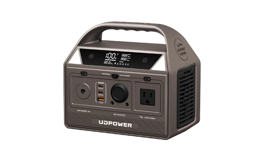
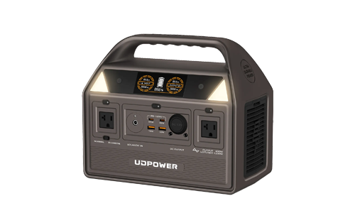
| UDPOWER S1200 |
 |
1191Wh | Pure sine wave 1200W (1800W max) | 12V–75V, 12A, 400W max | Fridge support windows, router + lights + charging, higher-demand loads, emergency home backup |
| UDPOWER C600 |
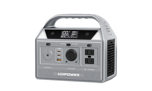
 |
596Wh | Pure sine wave (model series highlights 600W class with surge capacity) | See product page for input details (varies by configuration) | Comms + lighting + device charging; medium off-grid/outage essentials |
| UDPOWER C400 |
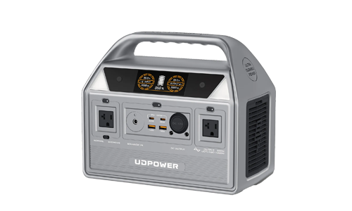
 |
256Wh | Pure sine wave 400W (800W surge listed on site menus/series pages) | See product page for input details | Short outages: phones, router, small electronics; compact grab-and-go |
If you’re sizing for winter, start with your must-run devices and the average watts they draw. Then pick capacity with a buffer for cold, conversion losses, and the reality that you may need longer coverage than you think.
FAQ
Does La Niña automatically mean a colder winter everywhere?
No. La Niña changes odds and storm-track tendencies, but regional outcomes vary. Weak La Niña events are especially variable, which is why NOAA/NASA emphasize uncertainty in real-world impacts.
Is the polar vortex “coming” or “collapsing” every time it gets cold?
Not necessarily. The polar vortex is always present. Sometimes it expands and helps send Arctic air south, but not every cold snap is “the polar vortex.”
What’s the most useful forecast to follow for decisions?
For action (travel, staffing, home prep), trust local NWS forecasts and warnings (1–10 days). Use CPC seasonal outlooks for broad planning, not exact timing.
If the CPC outlook says “above-normal temperatures,” should I stop prepping?
No. “Above normal” can still include major storms and short-lived Arctic outbreaks. Prep is about resilience, not chasing a single map.
What’s the safest winter backup-power approach?
Prioritize indoor-safe power for essentials (communication, basic lighting, health devices) and pair it with a clear plan: extension cords, device priorities, and realistic run times.
Sources & further reading (linked)
- NOAA CPC — ENSO Diagnostic Discussion (Dec 11, 2025)
- NASA Earth Observatory — “A Subtle Return of La Niña” (Dec 16, 2025)
- NOAA CPC — Seasonal Outlook Discussion (Jan–Mar 2026 narrative guidance)
- National Weather Service — What is the Polar Vortex?
- NWS Bismarck — Sudden Stratospheric Warming Events (explainer)
- USDA Climate Hubs — La Niña basics and typical U.S. contrasts
- CDC — Winter weather safety guidance
Related Articles