

Hurricane vs Tornado: Key Differences, Risks and Preparedness
Last updated: September 21, 2026
Hurricanes and tornadoes can both produce destructive winds, flying debris, power outages, injuries, and major property damage, but they are not simply large and small versions of the same storm. They form differently, operate on dramatically different scales, are classified using different methods, and require different safety decisions.
Quick Answer: What Is the Difference Between a Hurricane and a Tornado?
A hurricane is a large tropical cyclone that develops over warm ocean water and can remain active for days. It can affect hundreds of miles through sustained winds, storm surge, heavy rain, inland flooding, dangerous surf, and sometimes tornadoes.
A tornado is a much smaller, violently rotating column of air extending from a thunderstorm to the ground. Its destructive path is far narrower and it usually lasts much less time, but wind inside a powerful tornado can be more intense locally than hurricane winds.
The practical difference is just as important: hurricane preparedness is largely a lead-time and evacuation problem, while tornado preparedness is primarily a shelter and rapid-action problem.

Hurricane vs Tornado at a Glance
| Factor | Hurricane | Tornado | What It Means for You | Source |
|---|---|---|---|---|
| What it is | A large organized tropical cyclone made up of numerous thunderstorms | A violently rotating column of air extending from a thunderstorm to the ground | They are fundamentally different weather systems | NOAA AOML |
| Typical scale | Hundreds of kilometers across | Often hundreds of meters across | A hurricane can expose a huge region; tornado damage is generally concentrated along a narrower path | NOAA AOML |
| Duration | Measured in days | Commonly measured in minutes | Hurricane preparation must account for prolonged impacts and recovery | NOAA AOML |
| Formation | Develops over tropical or subtropical ocean waters | Develops from thunderstorms when atmospheric conditions support strong rotation | Forecasting and warning methods are very different | NOAA NSSL |
| Primary hazards | Wind, storm surge, rainfall flooding, waves, rip currents and tornadoes | Extreme localized wind and flying debris, plus hazards from the parent thunderstorm | Hurricane planning must consider water as well as wind | National Hurricane Center |
| Intensity scale | Saffir-Simpson Hurricane Wind Scale, Category 1–5 | Enhanced Fujita Scale, EF0–EF5 | The scales use different wind definitions and should not be directly matched | NHC / NWS |
| Preparation window | Potentially days, with watches and warnings before dangerous winds arrive | Conditions may be monitored for hours, but a Tornado Warning requires immediate shelter | Do not use a hurricane-style evacuation mindset during an active tornado warning | NHC / NWS |
| Power outage pattern | Can damage utility infrastructure across a broad region and cause prolonged outages | Can severely damage local lines and substations along or near the storm path | Backup power planning should consider both outage duration and essential load | UDPOWER Storm Outage Guide |
How Do Hurricanes and Tornadoes Form?
How a Hurricane Forms
A hurricane begins as an organized tropical weather system over warm ocean water. Heat and moisture from the ocean help fuel thunderstorms around a developing low-pressure circulation. When atmospheric and ocean conditions remain favorable, that circulation can organize and strengthen.
In the Atlantic and Northeast Pacific, a tropical cyclone is classified as a hurricane once its maximum sustained winds reach at least 74 mph. Before that point it may be classified as a tropical depression or tropical storm.
Hurricanes also need relatively low vertical wind shear to organize. Strong wind shear can disrupt the storm's vertical structure and interfere with development.
How a Tornado Forms
Tornado formation happens on a much smaller scale. Many significant tornadoes develop from rotating severe thunderstorms known as supercells, although tornadoes can occur in other thunderstorm environments as well.
An unstable atmosphere and changes in wind speed or direction with height can help establish rotation inside a thunderstorm. Under the right conditions, that rotation can tighten and extend toward the ground.
This is one reason a tornado is not simply a “mini hurricane.” Hurricanes generally need relatively low environmental vertical wind shear to develop successfully, while significant wind shear is an important ingredient in many tornadic thunderstorm environments.
Which Is Bigger: a Hurricane or Tornado?
A hurricane is dramatically larger.
NOAA describes tropical cyclones as being on the scale of hundreds of kilometers, while tornadoes are generally on the scale of hundreds of meters. The exact dimensions vary enormously from storm to storm, but the orders of magnitude are fundamentally different.
| Scale Question | Hurricane | Tornado | Practical Consequence | Source |
|---|---|---|---|---|
| Overall storm footprint | Can span hundreds of kilometers | Usually much narrower | Hurricanes can affect multiple communities or states at once | NOAA AOML |
| Damage pattern | Broad wind, rain, surge and flood impacts | Narrower corridor of extreme wind damage | Being outside a tornado track does not mean the surrounding thunderstorm is harmless | NHC |
| Infrastructure exposure | Potentially widespread | More geographically concentrated | Hurricane restoration can involve a much larger damaged utility network | UDPOWER Power Outage Checklist |
This difference in scale explains why a powerful tornado may destroy structures within a relatively narrow path while homes only a few miles away experience far less damage. A hurricane, by contrast, can expose an entire metropolitan area and surrounding counties to prolonged wind and rain.
Hurricane vs Tornado Wind Speed: Which Has Stronger Winds?
This question has a trap built into it.
The most violent tornadoes can have estimated winds above 200 mph, which exceeds the sustained-wind threshold of a Category 5 hurricane. But simply comparing those numbers is misleading because the two wind scales do not measure the same thing.
Hurricane Wind Measurement
The Saffir-Simpson Hurricane Wind Scale uses a hurricane's maximum sustained wind speed. In the United States, tropical cyclone sustained winds are based on a one-minute average.
Tornado Wind Measurement
The Enhanced Fujita Scale is primarily a damage-based scale. National Weather Service survey teams evaluate structures, trees and other damage indicators and estimate the wind speeds required to produce that damage. The EF wind values represent estimated three-second gusts at the point of damage.
That distinction matters. Saying “an EF3 is stronger than a Category 5 because the mph numbers overlap” ignores the difference between a brief estimated gust in a narrow tornado damage path and sustained winds associated with a much larger tropical cyclone.
Hurricane Categories vs Tornado EF Ratings
Saffir-Simpson Hurricane Wind Scale
| Hurricane Category | Maximum Sustained Wind | Wind-Damage Description | Important Limitation | Source |
|---|---|---|---|---|
| Category 1 | 74–95 mph | Very dangerous winds will produce some damage | The Saffir-Simpson scale measures wind only. It does not rate storm surge, rainfall flooding or tornado risk. | National Hurricane Center |
| Category 2 | 96–110 mph | Extremely dangerous winds will cause extensive damage | ||
| Category 3 | 111–129 mph | Devastating wind damage can occur | ||
| Category 4 | 130–156 mph | Catastrophic wind damage can occur | ||
| Category 5 | 157 mph or higher | Catastrophic wind damage can occur |
One of the most important hurricane safety lessons is that a lower hurricane category does not mean water hazards are minor. Storm surge and rainfall flooding are separate threats that are not represented by the category number.
Enhanced Fujita Tornado Scale
| EF Rating | Estimated 3-Second Gust | General Classification | How Rating Is Determined | Source |
|---|---|---|---|---|
| EF0 | 65–85 mph | Weak | NWS teams examine damage indicators and degrees of damage to estimate the wind range that most likely caused the observed damage. | National Weather Service |
| EF1 | 86–110 mph | Weak | ||
| EF2 | 111–135 mph | Strong | ||
| EF3 | 136–165 mph | Strong | ||
| EF4 | 166–200 mph | Violent | ||
| EF5 | Above 200 mph | Violent |
Another difference is timing: a hurricane has a category while forecasters are actively monitoring it. A tornado often receives its final EF rating after the event, once the damage has been surveyed.
Hurricane vs Tornado Damage: Which Causes More Destruction?
The answer depends on whether you mean damage intensity at one location or total damage across the affected region.
A violent tornado can subject a narrow corridor to extraordinarily intense winds and flying debris. A hurricane generally affects a vastly larger area and can combine several hazards at the same time: wind, storm surge, freshwater flooding, waves, falling trees and tornadoes.
NOAA notes that hurricanes generally produce more total destruction because of their much larger size, longer duration and multiple damage mechanisms. That does not make a tornado harmless by comparison. For a house directly in the path of a violent tornado, the local consequences can be catastrophic.
| Damage Type | Hurricane | Tornado | Planning Implication |
|---|---|---|---|
| Wind | Broad area, potentially lasting many hours | Very concentrated and potentially extreme | Both require protection from flying debris |
| Storm surge | Major coastal hazard | Not a tornado-specific hazard | Coastal hurricane evacuation zones must be taken seriously |
| Rainfall flooding | Can affect coastal and inland communities over a large area | The parent thunderstorm may cause heavy rain or flash flooding | Never drive through floodwater |
| Flying debris | Dangerous | Often one of the most serious immediate hazards | Protect the head and neck during a tornado |
| Tree and utility damage | Can be widespread | Can be severe within the affected corridor | Expect downed lines and blocked roads after either storm |
| Power outage | May involve large regional restoration operations | Can be severe locally and may be compounded by surrounding thunderstorms | Do not assume a narrow tornado track guarantees a short outage |
Why Hurricane Category Alone Does Not Tell You Your Flood Risk
The hurricane category is a wind scale. It does not tell you how deep storm surge will be at your location, how much rain will fall, whether a river will flood or whether a tornado will form in an outer rain band.
When a tropical cyclone approaches, check the complete set of local warnings rather than focusing only on “Category 1,” “Category 3” or “Category 5.”
Can a Hurricane Cause Tornadoes?
Yes. A hurricane or tropical storm can produce tornadoes, so the two hazards can occur during the same event.
According to the National Hurricane Center, tropical-cyclone tornadoes often develop in thunderstorms embedded within rain bands away from the storm center, although they can also occur near the eyewall. Many are relatively short-lived, but they can still be dangerous.
This is particularly important after landfall. People sometimes assume the tornado risk is over once the center of a hurricane moves inland, but tropical cyclone rain bands can continue producing severe weather away from the center.
For a deeper hurricane-specific preparation plan, see the UDPOWER Hurricane Preparedness in Louisiana guide.
Warning Time: The Biggest Preparedness Difference
The most useful difference for an ordinary household is not storm diameter or maximum wind speed. It is how much time you have to make a safe decision.
Hurricane Decision Clock
| Alert | Meaning | Typical Timing | Your Priority | Source |
|---|---|---|---|---|
| Hurricane Watch | Hurricane conditions are possible | Generally issued about 48 hours before the anticipated arrival of tropical-storm-force winds | Finish supplies, charging, property preparation and evacuation planning | National Hurricane Center |
| Hurricane Warning | Hurricane conditions are expected | Generally issued about 36 hours before the anticipated arrival of tropical-storm-force winds | Complete preparations and follow evacuation instructions immediately | National Hurricane Center |
The clock is tied to the expected arrival of tropical-storm-force winds, not necessarily the arrival of the hurricane's center. Once those winds begin, boarding windows, moving equipment or evacuating may become difficult or unsafe.
Tornado Decision Clock
| Alert | Meaning | What You Should Do | Source |
|---|---|---|---|
| Tornado Watch | Conditions are favorable for tornadoes and severe thunderstorms in or near the watch area | Stay alert, keep warnings enabled and make sure everyone can reach the pre-selected shelter quickly | National Weather Service |
| Tornado Warning | A tornado is imminent, occurring, indicated by radar or reported by spotters | Stop preparing and shelter immediately | National Weather Service |
Hurricane vs Tornado Safety: What Should You Do?
Before a Hurricane
- Know whether your home is in an evacuation or storm-surge zone.
- Identify more than one evacuation route.
- Charge phones, flashlights, power banks and backup power equipment before conditions deteriorate.
- Bring loose outdoor objects inside or secure them.
- Protect important documents from water.
- Prepare medications, pet supplies, drinking water and shelf-stable food.
- Fill your vehicle before evacuation traffic becomes heavy.
- Monitor the National Hurricane Center, local National Weather Service office and local emergency management.
FEMA guidance emphasizes knowing your evacuation route before the storm and evacuating immediately when instructed. A portable power station, generator or expensive appliance is never a reason to remain in an evacuation zone.
During a Hurricane
- Follow evacuation instructions from local authorities.
- If you are sheltering in place and officials have not ordered evacuation, stay inside a sturdy structure away from windows.
- Do not go outside during a temporary lull unless officials confirm conditions are safe. The eye may create a period of relative calm before dangerous winds return from another direction.
- Do not walk, swim or drive through floodwater.
- Keep electrical equipment away from water.
- Continue monitoring warnings because tornadoes may develop within the tropical cyclone.
Before a Tornado
- Choose your shelter before storms arrive.
- Preferred locations include a properly designed safe room, storm shelter or basement.
- If those are unavailable, identify a small interior room or hallway on the lowest floor of a sturdy building.
- Keep sturdy shoes, a flashlight and head protection in or near the shelter area.
- Keep your phone charged and Wireless Emergency Alerts enabled.
- Practice getting household members and pets into the shelter quickly.
For a detailed tornado action plan, read the Texas Tornado Emergency Guide: What to Do Before, During and After a Warning.
During a Tornado Warning
- Go to shelter immediately.
- Move to the lowest level you can safely reach.
- Put as many walls as possible between you and the outside.
- Stay away from windows and exterior doors.
- Protect your head and neck with your arms, a helmet, a heavy blanket or another protective covering.
- Do not open windows to “equalize pressure.” It wastes valuable time.
- Do not shelter under a highway overpass.
What If You Live in a Mobile Home, Apartment, RV or Are Driving?
Mobile or Manufactured Home
Mobile homes offer poor protection from tornadoes, even when tied down. During a period of tornado risk, identify a nearby sturdy building or designated storm shelter before a warning is issued.
The same planning principle matters for hurricanes. If officials order your area to evacuate, leave while roads and weather conditions still allow safe travel.
Apartment or Condo
If a tornado warning is issued and you cannot reach a basement or designated shelter, use the lowest accessible level and move into an interior hallway, bathroom, closet or other windowless interior space. Avoid large open rooms and exterior walls.
For hurricanes, know whether building management has a storm plan, whether elevators will operate during a power outage, and how you would leave if local officials order evacuation.
RV or Camper
An RV should not be treated as a tornado shelter. Before severe weather arrives, identify a sturdy building or public storm shelter you can reach quickly.
During a hurricane threat, RV travelers should plan earlier than people in substantial buildings. High-profile recreational vehicles are vulnerable to wind, and evacuation becomes more difficult as traffic and weather deteriorate.
If You Are Driving During a Tornado Threat
The best option is to reach a sturdy building or designated shelter. Do not park under a highway overpass. National Weather Service guidance warns that an overpass does not provide adequate tornado protection.
There is no single last-resort strategy that is appropriate in every road situation. Visibility, traffic, tornado movement, flooding and available structures all matter. The safest strategy is to avoid being on the road in the first place when significant severe weather is expected.
Hurricane vs Tornado Power Outages
Both storms can leave homes without electricity, but the outage problem can look very different.
After a Hurricane
A hurricane may damage transmission lines, substations, distribution lines, utility poles and trees across a broad region. Flooding and blocked roads can also slow access for repair crews. The National Hurricane Center notes that stronger hurricanes can produce outages lasting from days to weeks, and in severe situations even longer.
For households in hurricane-prone regions, it makes sense to plan for a backup-power problem that could last beyond one night.
After a Tornado
A tornado's direct damage corridor is usually much narrower, but utility poles, conductors, transformers and substations within that path can be heavily damaged. The surrounding severe thunderstorm may also cause additional outages through straight-line winds, lightning, hail and fallen trees.
The practical lesson is that you should not size backup power simply by asking, “Was this a hurricane or a tornado?” Instead ask:
- Which devices must continue operating?
- How many watts do they actually draw?
- How long could restoration realistically take?
- Can the battery be safely recharged?
- Would relocation be safer if the outage becomes prolonged?
For a time-based outage plan, see the UDPOWER 24-, 48- and 72-Hour Power Outage Checklist.
What Should You Power First?
| Priority | Typical Loads | Why They Come First |
|---|---|---|
| 1. Life and medical needs | Compatible medical equipment, mobility equipment, refrigerated medication where required | Failure may create an immediate health risk |
| 2. Communication | Phones, emergency radio, essential chargers | You need alerts, emergency contacts and official information |
| 3. Lighting | LED lights and rechargeable lanterns | Reduces falls and injuries after dark |
| 4. Food and medicine refrigeration | Refrigerator or freezer | Helps protect food and temperature-sensitive items |
| 5. Connectivity | Modem and Wi-Fi router | Useful only if the provider's upstream network remains operational |
| 6. Comfort and convenience | Fan, laptop, TV or small kitchen appliance | Use only after essential energy needs are protected |
Battery Power vs Fuel Generator Safety
Battery power stations do not create combustion exhaust while operating, which makes them useful for selected indoor backup loads when used according to the manufacturer's instructions. Gasoline, propane and other combustion generators are different.
The CDC says fuel-burning generators must be operated outdoors and more than 20 feet from windows, doors and vents. Never operate a combustion generator inside a home, garage or carport because carbon monoxide can build up without warning.
See the CDC carbon monoxide safety guidance for current generator precautions.
Backup Power for Hurricane and Tornado Outages
A portable power station cannot protect a structure from a hurricane or tornado, and it should never influence an evacuation or shelter decision. Its role begins after life-safety decisions are taken care of: keeping selected essential devices operating when utility power is unavailable.
For storm preparation, capacity and continuous output both matter. Capacity determines approximately how long your stored energy lasts. Output determines which devices the station can operate at the same time.
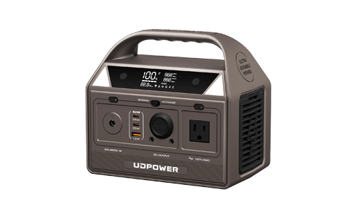
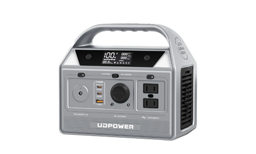
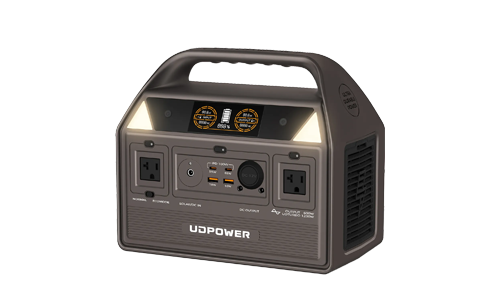
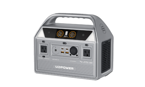
Explore the full UDPOWER portable power station range if your backup requirements are smaller or larger than the examples below.
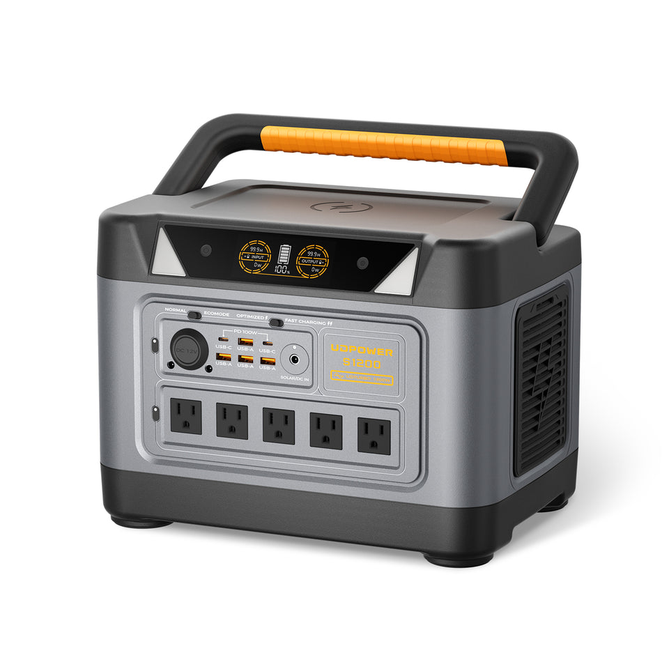
UDPOWER S1200: For Essential Household Backup
The UDPOWER S1200 is a practical option when the goal is to keep a smaller group of essentials running rather than attempt whole-home backup.
- Battery capacity: 1,190Wh LiFePO4
- Rated AC output: 1,200W pure sine wave
- UDTURBO output capability: up to 1,800W for compatible loads
- Solar input: up to 400W
- UPSPrime transfer: ≤10 ms
- Weight: approximately 26 lb
- Battery life: 4,000+ cycles listed by UDPOWER
- Warranty: 5 years
Best fit: phones, lighting, network equipment, CPAP or other compatible low-power equipment, laptops and carefully managed refrigerator backup.
View UDPOWER S1200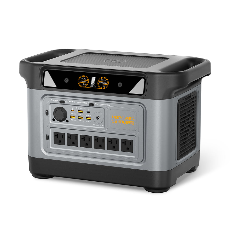
UDPOWER S2400: For Larger Loads and Longer Outages
The UDPOWER S2400 provides more stored energy and considerably more AC output, making it better suited to households that want to support several essential loads or prepare for a longer storm-related outage.
- Battery capacity: 2,083Wh LiFePO4
- Rated AC output: 2,400W pure sine wave
- UDTURBO output capability: up to 3,000W for compatible loads
- AC outlets: 6
- Solar charging: supports up to approximately 420W with a compatible setup
- UPSPrime transfer: ≤10 ms
- Weight: approximately 40.8 lb
- LiFePO4 battery: designed for long cycle life
- Warranty: 5 years
Best fit: refrigerator backup combined with communications, lighting, CPAP or other compatible devices, or households that want a larger stored-energy reserve for multi-day storm recovery.
View UDPOWER S2400Estimated Runtime by Continuous Load
A useful planning estimate is:
Runtime ≈ Battery capacity × 0.90 ÷ device watts
The following estimates use a 90% conversion-efficiency assumption. Real runtime can be shorter or longer depending on temperature, inverter losses, startup demand, cycling loads, battery state, operating mode and the actual appliance.
| Continuous Load | S1200 1,190Wh Estimated Runtime | S2400 2,083Wh Estimated Runtime | Possible Examples |
|---|---|---|---|
| 20W | About 53.5 hours | About 93.7 hours | Small communication or lighting load |
| 50W | About 21.4 hours | About 37.5 hours | Router plus small electronics or certain low-power devices |
| 100W | About 10.7 hours | About 18.7 hours | Moderate essential-load budget |
| 200W | About 5.4 hours | About 9.4 hours | Multiple electronics or a cycling appliance averaged to this load |
| 500W | About 2.1 hours | About 3.7 hours | Larger appliance load |
| 1,000W | About 1.1 hours | About 1.9 hours | High-power appliance used continuously |
A refrigerator does not normally draw its rated compressor power continuously, so dividing battery capacity by a refrigerator's nameplate wattage can give a misleading runtime estimate. Compressor cycling, ambient temperature, door openings and startup demand all matter.
S1200 or S2400 for a Storm Outage?
| Your Situation | Better Starting Point | Why |
|---|---|---|
| Phones, lights, router, laptop and smaller essential loads | S1200 | Lower weight with 1,190Wh of capacity and 1,200W rated AC output |
| Refrigerator plus several smaller essentials | S2400 | 2,083Wh capacity provides a larger energy reserve |
| Higher combined appliance load | S2400 | 2,400W rated AC output provides more output headroom |
| Short localized outage where only communication and lighting matter | S1200 may be sufficient | A larger battery is unnecessary if the actual energy budget is small |
| Hurricane region where multi-day restoration is possible | S2400 offers more reserve | Capacity becomes increasingly important as an outage extends overnight or longer |
For a regional example of planning around hurricane-related outages, see North Carolina Hurricane Power Outage: What Should You Prepare to Keep Running?
Hurricane vs Tornado Preparedness Checklist
A good emergency kit is useful for both hazards, but the way you organize it should reflect how quickly you may need to act.
Hurricane: 48+ Hours Before Potential Impact
- Check your evacuation zone.
- Identify evacuation routes and destination options.
- Fill prescriptions and prepare necessary medical supplies.
- Charge phones, backup batteries and portable power stations.
- Freeze reusable cold packs and reduce unnecessary refrigerator openings.
- Secure outdoor furniture and loose objects.
- Prepare drinking water and shelf-stable food.
- Move important documents into waterproof storage.
- Prepare pets and carriers.
- Monitor NHC, NWS and local emergency-management instructions.
Hurricane: Once Evacuation Is Ordered
- Leave promptly rather than waiting for conditions to deteriorate.
- Take identification, medications, water, chargers and essential supplies.
- Follow designated routes.
- Do not drive into floodwater.
- Do not stay behind simply to protect property or equipment.
Tornado Watch
- Review the shelter location.
- Put shoes, flashlights and head protection nearby.
- Bring pets indoors.
- Charge phones while time allows.
- Keep multiple warning methods active.
- If you live in a mobile home, move to a sturdy shelter before conditions become dangerous.
Tornado Warning
- Go to shelter immediately.
- Do not go outside to confirm the tornado visually.
- Do not waste time opening windows.
- Stay away from exterior walls and windows.
- Cover your head and neck.
- Remain sheltered until the warning has ended and conditions are safe.
After Either Storm
- Continue monitoring official alerts; additional storms may follow.
- Treat downed power lines as energized.
- Do not enter floodwater.
- Do not use wet electrical equipment.
- Use sturdy shoes and gloves around debris.
- Photograph property damage only when the area is safe.
- Check on household members and neighbors when conditions permit.
- Report utility outages and damaged infrastructure.
- Conserve battery capacity until you understand the likely outage duration.
- Recharge backup power only when you have a safe, supported charging source.
The Preparedness Rule Most People Miss
Do not make your emergency plan depend on being able to improvise after the warning arrives.
For hurricanes, know where you will go before an evacuation order. For tornadoes, know exactly which room you will use before the warning. For outages, know which appliances matter and how many watts they consume before the grid goes down.
The storm itself is a poor time to discover that your refrigerator requires more startup power than expected, your tornado shelter is full of storage boxes, your phone alerts are disabled or your evacuation route crosses a flood-prone road.
Hurricane Season vs Tornado Season
For the Atlantic basin, the official hurricane season runs from June 1 through November 30. The Eastern Pacific season begins May 15 and also ends November 30.
Tornadoes are less neatly confined to one national season. NOAA notes that they can occur at any time of year. The climatological peak shifts by region: the Gulf Coast tends to see an earlier peak, the southern Plains typically peak later in spring, and parts of the northern Plains and Upper Midwest peak later still.
| Hazard | Typical U.S. Timing | Important Exception | Source |
|---|---|---|---|
| Atlantic hurricanes | Official season: June 1–November 30 | Tropical cyclones can occur outside the official season | National Hurricane Center |
| Tornadoes | Peak varies by region, with spring and early summer important in many areas | Tornadoes can occur during any month and at any time of day | NOAA NSSL |
Hurricane vs Tornado: What Matters More Than the Name of the Storm?
For preparedness, the label is only the beginning. The most useful questions are local:
- Is my home in a storm-surge or evacuation zone?
- Is a Tornado Warning active for my location?
- Do I live in a mobile home or another structure that requires earlier relocation?
- Could flooding cut off my evacuation route?
- Does anyone in my household rely on powered medical equipment?
- Could utility restoration take several days?
- Where is my safest shelter?
- How will I receive warnings if internet service or power fails?
This impact-based approach is more useful than trying to decide whether hurricanes or tornadoes are universally “worse.” A narrow violent tornado and a large slow-moving hurricane create very different risks, but either can become life-threatening at the wrong place and time.
Frequently Asked Questions
Is a hurricane bigger than a tornado?
Yes. Hurricanes are vastly larger weather systems. NOAA describes tropical cyclones on the scale of hundreds of kilometers, while tornadoes are generally on the scale of hundreds of meters.
Is a tornado stronger than a hurricane?
A violent tornado can produce more intense local wind than the sustained wind found in a hurricane. However, that does not mean a tornado is simply “stronger.” Hurricanes act over much larger areas, last much longer and produce several hazards besides wind.
What is the difference between hurricane and tornado wind speed?
Hurricane categories are based on maximum sustained wind. Tornado EF ratings use estimated three-second gusts inferred primarily from observed damage. Because the methods are different, their mph values should not be compared as if they represent the same measurement.
Can a hurricane cause a tornado?
Yes. Hurricanes and tropical storms can produce tornadoes, particularly within thunderstorms embedded in rain bands, although tornadoes may also occur closer to the eyewall.
Can there be a tornado after a hurricane makes landfall?
Yes. Tropical cyclone rain bands can continue producing tornadoes after landfall and away from the storm center. Continue monitoring local tornado warnings even if the center of the hurricane has moved inland.
Which lasts longer, a hurricane or a tornado?
Hurricanes generally last much longer. Tropical cyclone lifetimes are measured in days, while tornado lifetimes are generally measured in minutes, although individual storms vary.
Which causes more damage, a hurricane or tornado?
Hurricanes generally cause damage over a much larger area because they last longer and combine wind, rainfall, storm surge, flooding and other hazards. A violent tornado, however, can produce catastrophic destruction within its much narrower path.
Is a Category 5 hurricane the same as an EF5 tornado?
No. Category 5 and EF5 are part of completely different scales. A hurricane category is based on maximum sustained wind, while an EF tornado rating is damage-based and uses estimated three-second gusts. The numbers should not be matched directly.
Should I evacuate during a tornado warning?
If you are already in a sturdy building, the normal response to a Tornado Warning is to shelter immediately rather than get into a vehicle. People in mobile homes should have a plan to reach a sturdy shelter before severe weather arrives. Follow current local National Weather Service and emergency-management instructions.
Should I evacuate during a hurricane?
Evacuate when local authorities instruct you to do so, particularly if you are in a storm-surge or evacuation zone or another vulnerable location. Do not delay departure until dangerous wind, floodwater or heavy traffic makes travel unsafe.
Where is the safest place during a tornado?
A properly designed storm shelter or safe room provides the strongest protection. Otherwise, use a basement or a small interior room on the lowest floor of a sturdy building, stay away from windows and protect your head and neck.
Can I hide under an overpass during a tornado?
No. National Weather Service guidance specifically advises against sheltering under highway overpasses. Seek a sturdy building or designated shelter whenever possible.
Can I use a portable power station during a storm?
A battery power station can support compatible essential devices during an outage, but keep it dry and operate it according to the manufacturer's instructions. Do not handle or operate electrical equipment where flooding, standing water or active water intrusion is present. Shelter and evacuation always take priority over backup power.
Can I use solar panels immediately after a hurricane or tornado?
Only after conditions are safe. Do not deploy portable solar panels during dangerous winds, lightning, flooding or active severe weather. Inspect panels, cables and connectors for damage and keep electrical connections dry before attempting to recharge a power station.
What should I power first after a hurricane or tornado?
Prioritize life-safety and medically necessary equipment first, followed by communication, essential lighting, temperature-sensitive medicine and food refrigeration. Comfort and entertainment loads should come later.
When is hurricane season compared with tornado season?
The Atlantic hurricane season officially runs from June 1 through November 30. Tornado timing varies by region and tornadoes can occur during any month of the year.
Authoritative Sources Used for This Guide
This article uses current definitions and safety guidance from NOAA, the National Hurricane Center, the National Weather Service, FEMA and the CDC. During an active emergency, forecasts and instructions from your local authorities take priority over general preparedness guidance.
- NOAA Atlantic Oceanographic and Meteorological Laboratory — Hurricanes vs Tornadoes
- National Hurricane Center — Saffir-Simpson Hurricane Wind Scale
- National Hurricane Center — Hurricane Hazards
- National Hurricane Center — Tropical Cyclone Watch and Warning Definitions
- National Weather Service — Enhanced Fujita Scale
- NOAA National Severe Storms Laboratory — Tornado Basics
- National Weather Service — Tornado Safety
- FEMA Ready.gov — Hurricane Preparedness
- CDC — Safety After a Hurricane or Tropical Storm
Build a Backup-Power Plan Before the Next Storm
The best time to calculate your essential power needs is before a hurricane watch or tornado warning appears on your phone. List the devices you actually need, check their wattage, estimate how many hours they must operate and choose enough battery capacity for that specific job.
A portable power station cannot replace a safe room, evacuation plan or official emergency instructions. What it can do is help keep essential communication, lighting, refrigeration and compatible devices operating when the grid is unavailable.
View UDPOWER Portable Power StationsRelated Articles


